
How PAS 128 works
Completed utility survey output data to PAS 128 standard, categorises each linear section of underground utility with a Quality Level (QL) code to indicate the quality, accuracy and confidence of an utility position and depth.
PAS 128 Quality Levels (QL)
Quality Levels set out the accuracy to which the survey data is captured for specific purposes, the quality expected of that data and a means by which to assess and indicate the confidence that can be placed in that data.
A PAS 128 compliant utility survey will consist of many underground utilities and it is possible that all of the Survey Category Types will be featured in some way. A particular single utility may have several QL designations along its route depending on whether it has been exposed (verified), successfully detected or taken from utility records at a particular section along it's length.A particular single utility may have several QL designations along its route depending on whether it has been exposed (verified), successfully detected or taken from utility records at a particular section along its length.
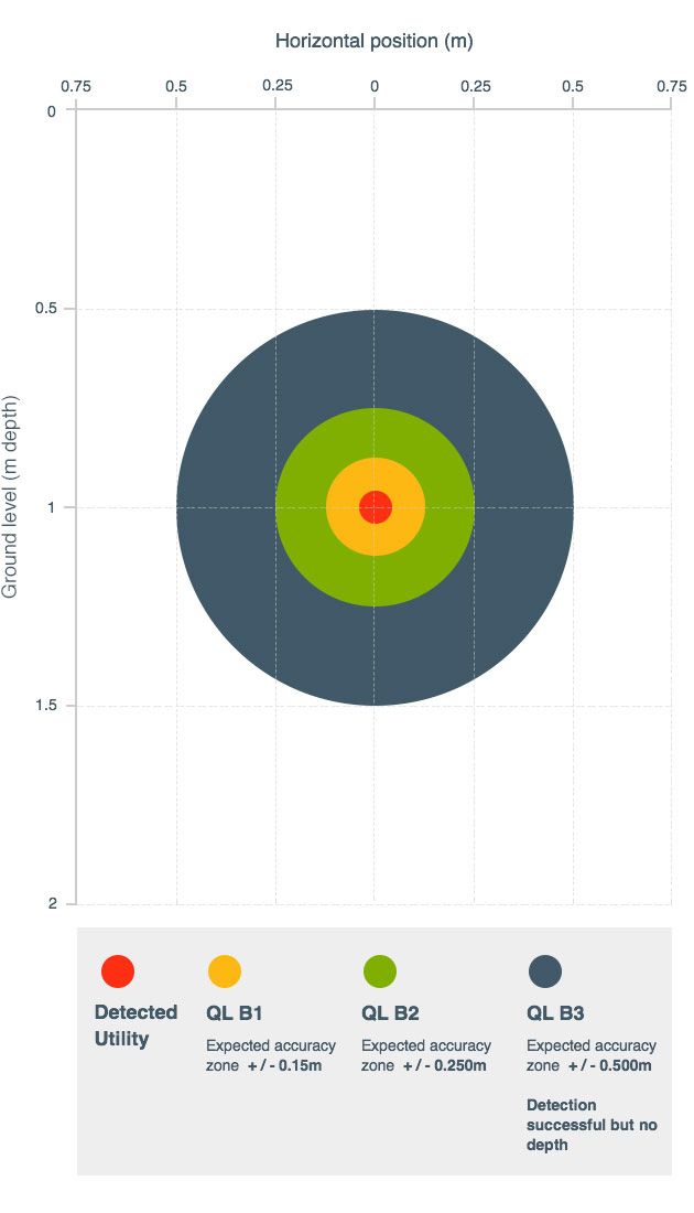
PAS 128 Survey Type B Accuracy Levels Example
Please see below a diagram that depicts the Survey Type B quality/accuracy levels. This diagram assumes a utility depth of 1 metre and indicates the expected accuracy achieved by the survey practitioner. Each linear section of detected utility is represented with a quality code of this type. This enables you to plan your projects with greater confidence with regard to utility infrastructure than ever before. This also enables you to highlight any areas of concern that may require other alternative survey methods such as strategic vacuum excavation to expose and verify the survey's findings.
Education, technical awareness presentations and briefings